
Billing topographic map
Interactive map
Click on the map to display elevation.
About this map
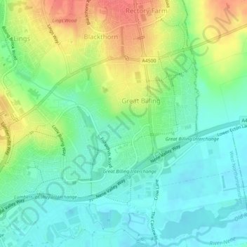
Name: Billing topographic map, elevation, terrain.
Average elevation: 69 m
Minimum elevation: 48 m
Maximum elevation: 106 m
Other topographic maps
Click on a map to view its topography, its elevation and its terrain.
Northampton
Verenigd Koninkrijk > Engeland > West Northamptonshire > Northampton
Northampton, West Northamptonshire, East Midlands, Engeland, Verenigd Koninkrijk
Average elevation: 89 m