
Thank you for supporting this site ❤️
Make a donation
Make a donation
West Frisian Islands topographic map
Click on the map to display elevation.
Thank you for supporting this site ❤️
Make a donation
Make a donation
About this map
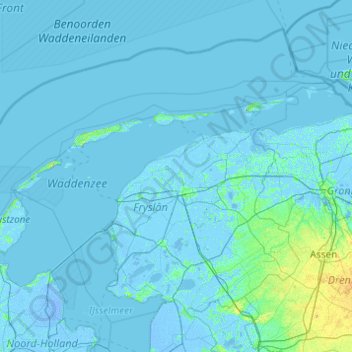
Name: West Frisian Islands topographic map, elevation, terrain.
Location: West Frisian Islands, Frisia, Netherlands (52.95963 4.66313 53.55349 6.61932)
Average elevation: 1 m
Minimum elevation: -7 m
Maximum elevation: 46 m
Thank you for supporting this site ❤️
Make a donation
Make a donation
Other topographic maps
Click on a map to view its topography, its elevation and its terrain.