
Thank you for supporting this site ❤️
Make a donation
Make a donation
Ko Olina topographic map
Click on the map to display elevation.
Thank you for supporting this site ❤️
Make a donation
Make a donation
About this map
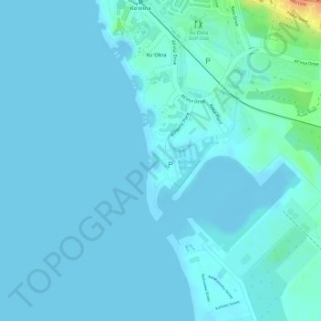
Name: Ko Olina topographic map, elevation, terrain.
Location: Ko Olina, Kapolei, Honolulu County, Hawaii, United States (21.32723 -158.12270 21.32919 -158.12187)
Average elevation: 5 m
Minimum elevation: -3 m
Maximum elevation: 45 m
Thank you for supporting this site ❤️
Make a donation
Make a donation
Other topographic maps
Click on a map to view its topography, its elevation and its terrain.