
Thank you for supporting this site ❤️
Make a donation
Make a donation
Lago del Mucrone topographic map
Click on the map to display elevation.
Thank you for supporting this site ❤️
Make a donation
Make a donation
About this map
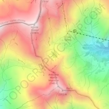
Name: Lago del Mucrone topographic map, elevation, terrain.
Location: Lago del Mucrone, Biella, Piemonte, Italia (45.62738 7.94259 45.62894 7.94438)
Average elevation: 1,918 m
Minimum elevation: 1,365 m
Maximum elevation: 2,364 m
Thank you for supporting this site ❤️
Make a donation
Make a donation
Other topographic maps
Click on a map to view its topography, its elevation and its terrain.