
Thank you for supporting this site ❤️
Make a donation
Make a donation
Herndon topographic map
Click on the map to display elevation.
Thank you for supporting this site ❤️
Make a donation
Make a donation
About this map
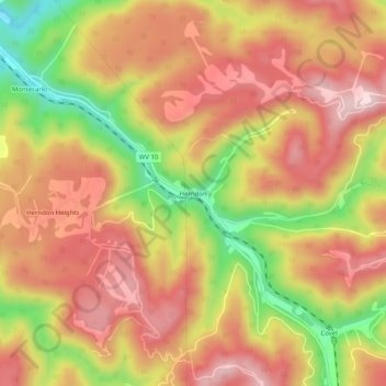
Name: Herndon topographic map, elevation, terrain.
Location: Herndon, Wyoming County, West Virginia, 24726, United States (37.48539 -81.36038 37.52539 -81.32038)
Average elevation: 717 m
Minimum elevation: 507 m
Maximum elevation: 857 m
Thank you for supporting this site ❤️
Make a donation
Make a donation
Other topographic maps
Click on a map to view its topography, its elevation and its terrain.