
Sabrosa topographic map
Interactive map
Click on the map to display elevation.
About this map
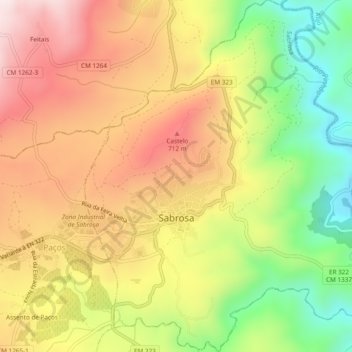
Name: Sabrosa topographic map, elevation, terrain.
Location: Sabrosa, Vila Real, Douro, Norte, Portugal (41.25277 -7.58819 41.28851 -7.54230)
Average elevation: 545 m
Minimum elevation: 241 m
Maximum elevation: 818 m