
Thank you for supporting this site ❤️
Make a donation
Make a donation
Stephensburg topographic map
Click on the map to display elevation.
Thank you for supporting this site ❤️
Make a donation
Make a donation
About this map
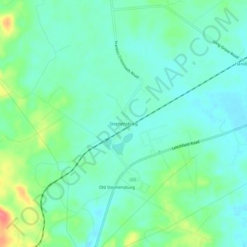
Name: Stephensburg topographic map, elevation, terrain.
Location: Stephensburg, Hardin County, Kentucky, 42724, United States (37.60478 -86.03885 37.64478 -85.99885)
Average elevation: 216 m
Minimum elevation: 198 m
Maximum elevation: 265 m
Thank you for supporting this site ❤️
Make a donation
Make a donation
Other topographic maps
Click on a map to view its topography, its elevation and its terrain.