
Thank you for supporting this site ❤️
Make a donation
Make a donation
Cherangany topographic map
Click on the map to display elevation.
Thank you for supporting this site ❤️
Make a donation
Make a donation
About this map
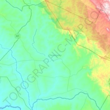
Name: Cherangany topographic map, elevation, terrain.
Location: Cherangany, Trans-Nzoia County, Rift Valley, Kenya (0.88927 35.05333 1.19823 35.36329)
Average elevation: 1,994 m
Minimum elevation: 1,767 m
Maximum elevation: 2,861 m
Thank you for supporting this site ❤️
Make a donation
Make a donation