
Bethesda topographic map
Interactive map
Click on the map to display elevation.
About this map
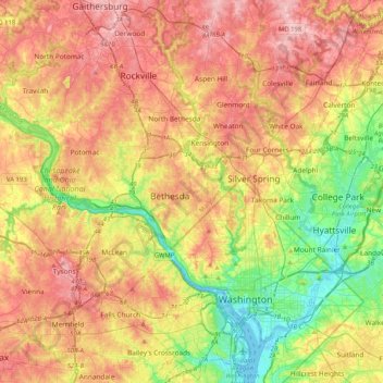
Name: Bethesda topographic map, elevation, terrain.
Location: Bethesda, Montgomery County, Maryland, 22814, USA (38.82483 -77.25465 39.14483 -76.93465)
Average elevation: 86 m
Minimum elevation: -3 m
Maximum elevation: 172 m