
Thank you for supporting this site ❤️
Make a donation
Make a donation
McNeill topographic map
Click on the map to display elevation.
Thank you for supporting this site ❤️
Make a donation
Make a donation
About this map
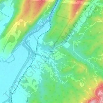
Name: McNeill topographic map, elevation, terrain.
Location: McNeill, Hardy County, West Virginia, United States (39.12011 -78.93336 39.16011 -78.89336)
Average elevation: 294 m
Minimum elevation: 217 m
Maximum elevation: 487 m
Thank you for supporting this site ❤️
Make a donation
Make a donation
Other topographic maps
Click on a map to view its topography, its elevation and its terrain.