
Thank you for supporting this site ❤️
Make a donation
Make a donation
Narchyang topographic map
Click on the map to display elevation.
Thank you for supporting this site ❤️
Make a donation
Make a donation
About this map
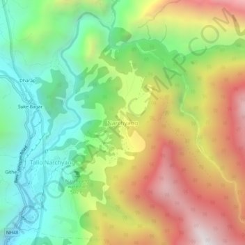
Name: Narchyang topographic map, elevation, terrain.
Location: Narchyang, Annapurna, Myagdi, Gandaki Province, Nepal (28.50037 83.65640 28.54037 83.69640)
Average elevation: 1,896 m
Minimum elevation: 1,241 m
Maximum elevation: 2,789 m
Thank you for supporting this site ❤️
Make a donation
Make a donation
Other topographic maps
Click on a map to view its topography, its elevation and its terrain.