
Thank you for supporting this site ❤️
Make a donation
Make a donation
Kaltungo topographic map
Click on the map to display elevation.
Thank you for supporting this site ❤️
Make a donation
Make a donation
About this map
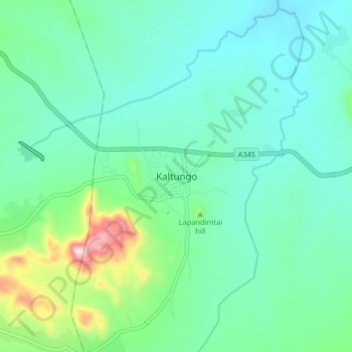
Name: Kaltungo topographic map, elevation, terrain.
Location: Kaltungo, Gombe State, 770109, Nigeria (9.77975 11.27185 9.85975 11.35185)
Average elevation: 499 m
Minimum elevation: 393 m
Maximum elevation: 897 m
Thank you for supporting this site ❤️
Make a donation
Make a donation