Geolocate

Shijiazhuang City topographic map

Interactive map

Click on the map to display elevation.

About this map

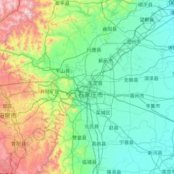
Name: Shijiazhuang City topographic map, elevation, terrain.

Location: Shijiazhuang City, Hebei, China (37.44111 113.51718 38.76263 115.47707)

Average elevation: 360 m

Minimum elevation: 19 m

Maximum elevation: 2,247 m

Other topographic maps

Click on a map to view its topography, its elevation and its terrain.

Baoding City

China > Hebei > Baoding City

Elevations in Baoding's administrative area decrease from northwest to southeast. The western parts are dominated by mountains and hills that are generally more than 1,000 metres (3,300 ft) tall; this area includes parts of Laishui, Yi, Mancheng, Shunping, Tang and Fuping Counties as well as the entirety of…

Average elevation: 343 m