
永平镇 topographic map
Interactive map
Click on the map to display elevation.
About this map
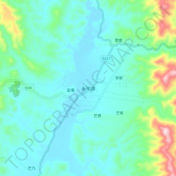
Name: 永平镇 topographic map, elevation, terrain.
Location: 永平镇, 景谷傣族彝族自治县, 普洱市, 云南省, 中国 (23.37872 100.35637 23.45872 100.43637)
Average elevation: 1,140 m
Minimum elevation: 1,060 m
Maximum elevation: 1,476 m
Other topographic maps
Click on a map to view its topography, its elevation and its terrain.