
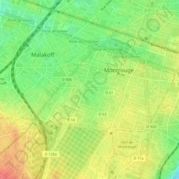
Quartier Jean Jaurès topographic map
Interactive map
Click on the map to display elevation.
About this map
Name: Quartier Jean Jaurès topographic map, elevation, terrain.
Average elevation: 78 m
Minimum elevation: 48 m
Maximum elevation: 106 m
Other topographic maps
Click on a map to view its topography, its elevation and its terrain.
Quartier Ferry-Buffalo
France > Île-de-France > Montrouge
Quartier Ferry-Buffalo, Montrouge, Antony, Hauts-de-Seine, Île-de-France, France métropolitaine, 92120, France
Average elevation: 77 m