
Caergwrle topographic map
Interactive map
Click on the map to display elevation.
About this map
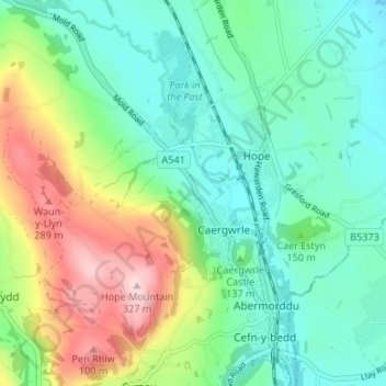
Name: Caergwrle topographic map, elevation, terrain.
Location: Caergwrle, Flintshire, Wales, LL12 9LT, United Kingdom (53.09418 -3.06521 53.13418 -3.02521)
Average elevation: 141 m
Minimum elevation: 61 m
Maximum elevation: 323 m