
Thank you for supporting this site ❤️
Make a donation
Make a donation
Merklingen topographic map
Click on the map to display elevation.
Thank you for supporting this site ❤️
Make a donation
Make a donation
About this map
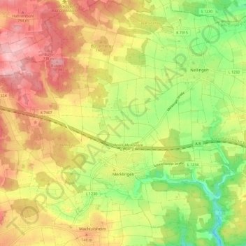
Name: Merklingen topographic map, elevation, terrain.
Average elevation: 711 m
Minimum elevation: 628 m
Maximum elevation: 788 m
Thank you for supporting this site ❤️
Make a donation
Make a donation
Other topographic maps
Click on a map to view its topography, its elevation and its terrain.
Balzheim
Deutschland > Baden-Württemberg > Alb-Donau-Kreis > Balzheim > Balzheim
Average elevation: 548 m
Rißtissen
Deutschland > Baden-Württemberg > Alb-Donau-Kreis > Ehingen (Donau)
Average elevation: 494 m