
Thank you for supporting this site ❤️
Make a donation
Make a donation
Sunne kommun topographic map
Click on the map to display elevation.
Thank you for supporting this site ❤️
Make a donation
Make a donation
About this map
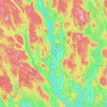
Name: Sunne kommun topographic map, elevation, terrain.
Location: Sunne kommun, Värmland County, Sweden (59.65118 12.58445 60.12289 13.38710)
Average elevation: 194 m
Minimum elevation: 52 m
Maximum elevation: 437 m
Thank you for supporting this site ❤️
Make a donation
Make a donation
Other topographic maps
Click on a map to view its topography, its elevation and its terrain.