
Thank you for supporting this site ❤️
Make a donation
Make a donation
Mount Gainor topographic map
Click on the map to display elevation.
Thank you for supporting this site ❤️
Make a donation
Make a donation
About this map
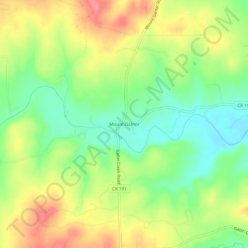
Name: Mount Gainor topographic map, elevation, terrain.
Location: Mount Gainor, Hays County, Texas, United States (30.12382 -98.15501 30.16382 -98.11501)
Average elevation: 373 m
Minimum elevation: 332 m
Maximum elevation: 421 m
Thank you for supporting this site ❤️
Make a donation
Make a donation
Other topographic maps
Click on a map to view its topography, its elevation and its terrain.