
Thank you for supporting this site ❤️
Make a donation
Make a donation
East Silver Springs Shore topographic map
Click on the map to display elevation.
Thank you for supporting this site ❤️
Make a donation
Make a donation
About this map
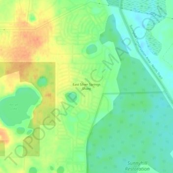
Name: East Silver Springs Shore topographic map, elevation, terrain.
Average elevation: 24 m
Minimum elevation: 6 m
Maximum elevation: 47 m
Thank you for supporting this site ❤️
Make a donation
Make a donation
Other topographic maps
Click on a map to view its topography, its elevation and its terrain.
Rainbow Springs State Park
United States > Florida > Marion County > Rainbow Falls
Average elevation: 21 m
Thank you for supporting this site ❤️
Make a donation
Make a donation