
Thank you for supporting this site ❤️
Make a donation
Make a donation
Spring Creek Mesa topographic map
Click on the map to display elevation.
Thank you for supporting this site ❤️
Make a donation
Make a donation
About this map
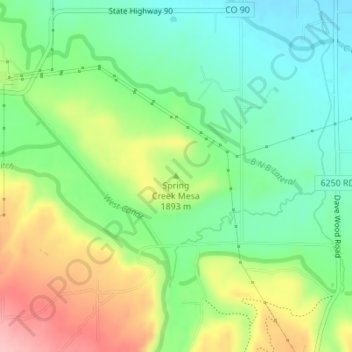
Name: Spring Creek Mesa topographic map, elevation, terrain.
Average elevation: 1,884 m
Minimum elevation: 1,828 m
Maximum elevation: 1,974 m
Thank you for supporting this site ❤️
Make a donation
Make a donation
Other topographic maps
Click on a map to view its topography, its elevation and its terrain.
Montrose
United States > Colorado > Montrose County
Montrose features a semi-arid Continental climate zone. The town sits on high grasslands in the Uncompahgre Valley of Western Colorado. Snowfall occurs during the winter but is usually short-lived due to the high altitude and abundant sunshine.
Average elevation: 1,803 m
Thank you for supporting this site ❤️
Make a donation
Make a donation