
Thank you for supporting this site ❤️
Make a donation
Make a donation
Dire Dawa topographic map
Click on the map to display elevation.
Thank you for supporting this site ❤️
Make a donation
Make a donation
About this map
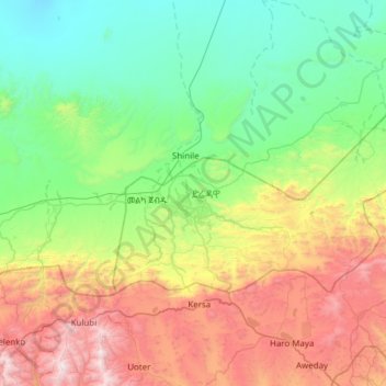
Name: Dire Dawa topographic map, elevation, terrain.
Location: Dire Dawa, Ethiopia (9.47249 41.72895 9.78472 42.34071)
Average elevation: 1,395 m
Minimum elevation: 737 m
Maximum elevation: 2,892 m
Thank you for supporting this site ❤️
Make a donation
Make a donation