
Edinburg topographic map
Interactive map
Click on the map to display elevation.
About this map
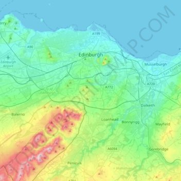
Name: Edinburg topographic map, elevation, terrain.
Location: Edinburg, Schottland, Vereinigtes Königreich (55.81879 -3.44953 56.00408 -3.07495)
Average elevation: 118 m
Minimum elevation: 0 m
Maximum elevation: 578 m
Other topographic maps
Click on a map to view its topography, its elevation and its terrain.
Edinburg
Vereinigtes Königreich > Schottland > Edinburg
Edinburg, City of Edinburgh, Schottland, EH1 1BB, Vereinigtes Königreich
Average elevation: 105 m