
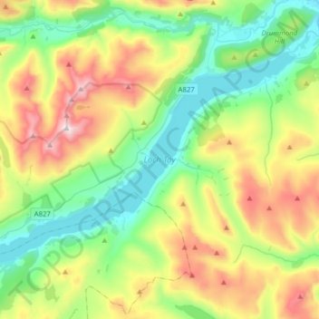
Kenmore topographic map
Interactive map
Click on the map to display elevation.
About this map
Name: Kenmore topographic map, elevation, terrain.
Average elevation: 460 m
Minimum elevation: 93 m
Maximum elevation: 1,204 m
Other topographic maps
Click on a map to view its topography, its elevation and its terrain.
Perth
Verenigd Koninkrijk > Schotland > Perth and Kinross
Perth, Perth and Kinross, Schotland, PH1 5SU, Verenigd Koninkrijk
Average elevation: 131 m
Kilspindie
Verenigd Koninkrijk > Schotland > Perth and Kinross
Kilspindie, Perth and Kinross, Schotland, PH2 7RX, Verenigd Koninkrijk
Average elevation: 82 m
Ardtalnaig
Verenigd Koninkrijk > Schotland > Perth and Kinross
Ardtalnaig, Perth and Kinross, Schotland, PH15 2HX, Verenigd Koninkrijk
Average elevation: 275 m