
Thank you for supporting this site ❤️
Make a donation
Make a donation
Kirkenes topographic map
Click on the map to display elevation.
Thank you for supporting this site ❤️
Make a donation
Make a donation
About this map
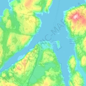
Name: Kirkenes topographic map, elevation, terrain.
Location: Kirkenes, South Varanki, Troms og Finnmark, 9900, Norway (69.68715 30.00490 69.76715 30.08490)
Average elevation: 63 m
Minimum elevation: -15 m
Maximum elevation: 275 m
Thank you for supporting this site ❤️
Make a donation
Make a donation
Other topographic maps
Click on a map to view its topography, its elevation and its terrain.