
Thank you for supporting this site ❤️
Make a donation
Make a donation
Westland topographic map
Click on the map to display elevation.
Thank you for supporting this site ❤️
Make a donation
Make a donation
About this map
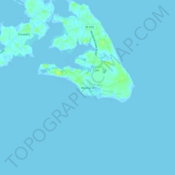
Name: Westland topographic map, elevation, terrain.
Location: Westland, Lancaster County, Virginia, United States (37.59708 -76.31272 37.63708 -76.27272)
Average elevation: 1 m
Minimum elevation: -6 m
Maximum elevation: 14 m
Thank you for supporting this site ❤️
Make a donation
Make a donation
Other topographic maps
Click on a map to view its topography, its elevation and its terrain.