
Eket topographic map
Click on the map to display elevation.
About this map
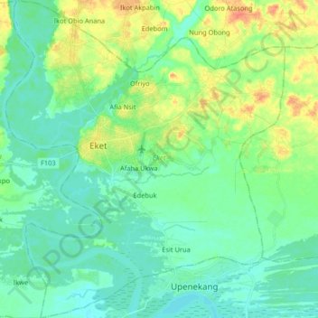
Name: Eket topographic map, elevation, terrain.
Location: Eket, Akwa Ibom State, Nigeria (4.55414 7.87913 4.71622 8.02217)
Average elevation: 12 m
Minimum elevation: -1 m
Maximum elevation: 40 m
Other topographic maps
Click on a map to view its topography, its elevation and its terrain.