
Sisseton topographic map
Interactive map
Click on the map to display elevation.
About this map
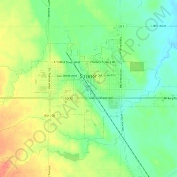
Name: Sisseton topographic map, elevation, terrain.
Location: Sisseton, Roberts County, South Dakota, 57262, USA (45.65187 -97.06651 45.67215 -97.01495)
Average elevation: 376 m
Minimum elevation: 354 m
Maximum elevation: 402 m