
Llandeilo topographic map
Interactive map
Click on the map to display elevation.
About this map
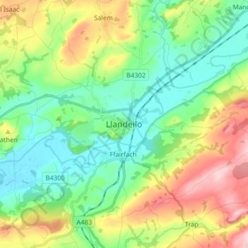
Name: Llandeilo topographic map, elevation, terrain.
Location: Llandeilo, Carmarthenshire, Wales, SA19, Verenigd Koninkrijk (51.84539 -4.03251 51.92539 -3.95251)
Average elevation: 102 m
Minimum elevation: 17 m
Maximum elevation: 268 m