
Thank you for supporting this site ❤️
Make a donation
Make a donation
Phú Quốc topographic map
Click on the map to display elevation.
Thank you for supporting this site ❤️
Make a donation
Make a donation
About this map
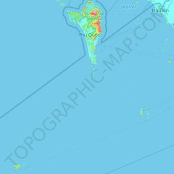
Name: Phú Quốc topographic map, elevation, terrain.
Location: Phú Quốc, Đặc khu Thổ Châu, An Giang Province, Vietnam (9.25430 103.45043 10.45260 104.09849)
Average elevation: 3 m
Minimum elevation: -1 m
Maximum elevation: 532 m
Thank you for supporting this site ❤️
Make a donation
Make a donation
Other topographic maps
Click on a map to view its topography, its elevation and its terrain.