
Thank you for supporting this site ❤️
Make a donation
Make a donation
Winfield topographic map
Click on the map to display elevation.
Thank you for supporting this site ❤️
Make a donation
Make a donation
About this map
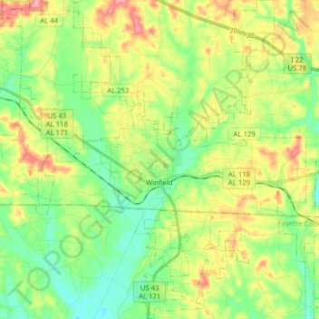
Name: Winfield topographic map, elevation, terrain.
Location: Winfield, Marion County, Alabama, 35594, United States (33.87386 -87.85455 34.00338 -87.74142)
Average elevation: 166 m
Minimum elevation: 123 m
Maximum elevation: 237 m
Thank you for supporting this site ❤️
Make a donation
Make a donation
Other topographic maps
Click on a map to view its topography, its elevation and its terrain.