
Penedono e Granja topographic map
Interactive map
Click on the map to display elevation.
About this map
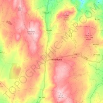
Name: Penedono e Granja topographic map, elevation, terrain.
Location: Penedono e Granja, Penedono, Viseu, Portugal (40.95828 -7.43815 41.03324 -7.34057)
Average elevation: 855 m
Minimum elevation: 632 m
Maximum elevation: 999 m
Other topographic maps
Click on a map to view its topography, its elevation and its terrain.