
Thank you for supporting this site ❤️
Make a donation
Make a donation
Tomhegan Township topographic map
Click on the map to display elevation.
Thank you for supporting this site ❤️
Make a donation
Make a donation
About this map
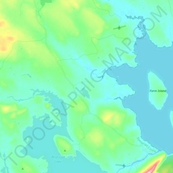
Name: Tomhegan Township topographic map, elevation, terrain.
Average elevation: 347 m
Minimum elevation: 309 m
Maximum elevation: 547 m
Thank you for supporting this site ❤️
Make a donation
Make a donation
Other topographic maps
Click on a map to view its topography, its elevation and its terrain.
Jones Pond
United States > Maine > Somerset County > Bald Mountain Township T4 R3
Average elevation: 503 m