Geolocate

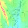
Holy Ghost topographic map

Click on the map to display elevation.

About this map

Name: Holy Ghost topographic map, elevation, terrain.

Location: Holy Ghost, San Miguel County, New Mexico, 87573, United States (35.74003 -105.71252 35.78003 -105.67252)

Average elevation: 2,626 m

Minimum elevation: 2,337 m

Maximum elevation: 2,931 m

Other topographic maps

Click on a map to view its topography, its elevation and its terrain.

Pecos

United States > New Mexico > San Miguel County

Average elevation: 2,131 m

Las Vegas

United States > New Mexico > San Miguel County

Average elevation: 1,994 m

Las Vegas

United States > New Mexico > San Miguel County

Average elevation: 1,994 m

Las Vegas

United States > New Mexico > San Miguel County

Average elevation: 1,994 m