
Thank you for supporting this site ❤️
Make a donation
Make a donation
Llansadwrn topographic map
Click on the map to display elevation.
Thank you for supporting this site ❤️
Make a donation
Make a donation
About this map
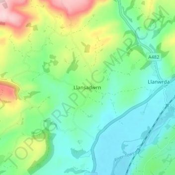
Name: Llansadwrn topographic map, elevation, terrain.
Location: Llansadwrn, Carmarthenshire, Wales, SA19 8LE, United Kingdom (51.94678 -3.92184 51.98678 -3.88184)
Average elevation: 120 m
Minimum elevation: 39 m
Maximum elevation: 311 m
Thank you for supporting this site ❤️
Make a donation
Make a donation
Other topographic maps
Click on a map to view its topography, its elevation and its terrain.