
Agen topographic map
Interactive map
Click on the map to display elevation.
About this map
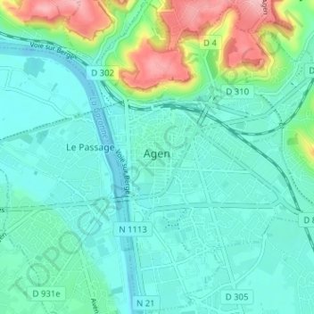
Name: Agen topographic map, elevation, terrain.
Average elevation: 67 m
Minimum elevation: 35 m
Maximum elevation: 172 m
Du 1er juillet 1939 au 21 septembre 2005, la station est à l'aéroport d'Agen-la-Garenne à 44,17667, 0,595, à 59 m d'altitude.Depuis le 22 septembre 2005, la station est à 44,1722, 0,59472, à 58 m d'altitude.