
Thank you for supporting this site ❤️
Make a donation
Make a donation
Мамисон topographic map
Click on the map to display elevation.
Thank you for supporting this site ❤️
Make a donation
Make a donation
About this map
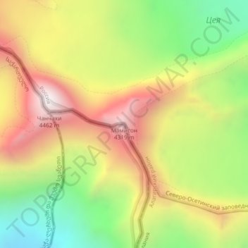
Name: Мамисон topographic map, elevation, terrain.
Average elevation: 3,732 m
Minimum elevation: 3,101 m
Maximum elevation: 4,384 m
Thank you for supporting this site ❤️
Make a donation
Make a donation
Other topographic maps
Click on a map to view its topography, its elevation and its terrain.
Цейское сельское поселение
Russia > Republic of North Ossetia – Alania > Alagirsky District
Average elevation: 2,269 m