
Thank you for supporting this site ❤️
Make a donation
Make a donation
Kankan topographic map
Click on the map to display elevation.
Thank you for supporting this site ❤️
Make a donation
Make a donation
About this map
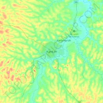
Name: Kankan topographic map, elevation, terrain.
Location: Kankan, Kankan-Centre, Kankan Region, Guinea (10.22352 -9.46694 10.54352 -9.14694)
Average elevation: 400 m
Minimum elevation: 357 m
Maximum elevation: 507 m
Thank you for supporting this site ❤️
Make a donation
Make a donation