
Santa Rosa topographic map
Interactive map
Click on the map to display elevation.
About this map
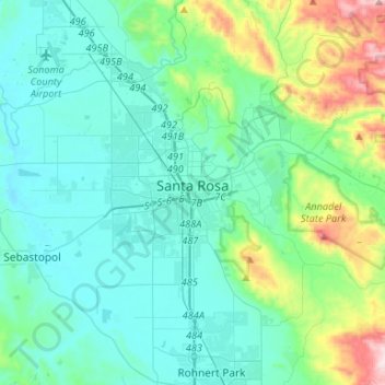
Name: Santa Rosa topographic map, elevation, terrain.
Location: Santa Rosa, Sonoma County, California, USA (38.36370 -122.83406 38.50699 -122.57303)
Average elevation: 133 m
Minimum elevation: 7 m
Maximum elevation: 712 m