
Whitchurch topographic map
Click on the map to display elevation.
About this map
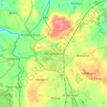
Name: Whitchurch topographic map, elevation, terrain.
Location: Whitchurch, Shropshire, England, SY13 1AU, United Kingdom (52.92927 -2.72395 53.00927 -2.64395)
Average elevation: 100 m
Minimum elevation: 58 m
Maximum elevation: 161 m
Other topographic maps
Click on a map to view its topography, its elevation and its terrain.