
Robertsganj topographic map
Interactive map
Click on the map to display elevation.
About this map
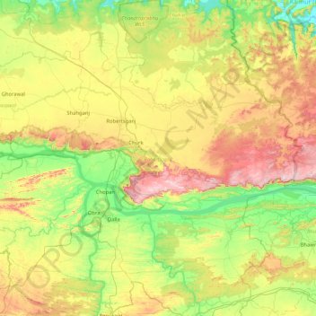
Name: Robertsganj topographic map, elevation, terrain.
Location: Robertsganj, Sonbhadra, Uttar Pradesh, India (24.29387 82.71300 24.90189 83.54815)
Average elevation: 290 m
Minimum elevation: 95 m
Maximum elevation: 642 m
Other topographic maps
Click on a map to view its topography, its elevation and its terrain.
Markundi
India > Uttar Pradesh > Robertsganj
Markundi, Robertsganj, Sonbhadra District, Uttar Pradesh, 231209, India
Average elevation: 302 m