
Thank you for supporting this site ❤️
Make a donation
Make a donation
Fischbachau topographic map
Click on the map to display elevation.
Thank you for supporting this site ❤️
Make a donation
Make a donation
About this map
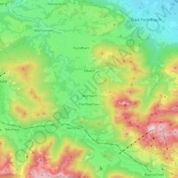
Name: Fischbachau topographic map, elevation, terrain.
Location: Fischbachau, Landkreis Miesbach, Beieren, 83730, Duitsland (47.67155 11.88444 47.78732 12.02302)
Average elevation: 928 m
Minimum elevation: 471 m
Maximum elevation: 1,803 m
Thank you for supporting this site ❤️
Make a donation
Make a donation
Other topographic maps
Click on a map to view its topography, its elevation and its terrain.