
Thank you for supporting this site ❤️
Make a donation
Make a donation
Langdale Knott topographic map
Click on the map to display elevation.
Thank you for supporting this site ❤️
Make a donation
Make a donation
About this map
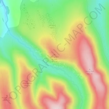
Name: Langdale Knott topographic map, elevation, terrain.
Average elevation: 386 m
Minimum elevation: 234 m
Maximum elevation: 552 m
Thank you for supporting this site ❤️
Make a donation
Make a donation
Other topographic maps
Click on a map to view its topography, its elevation and its terrain.
Barrow-in-Furness
United Kingdom > England > Westmorland and Furness > Askam-in-Furness
Average elevation: 22 m
Thank you for supporting this site ❤️
Make a donation
Make a donation
Toddygill Plantation
United Kingdom > England > Westmorland and Furness > Warcop
Average elevation: 172 m