
Thank you for supporting this site ❤️
Make a donation
Make a donation
Greta Valley topographic map
Click on the map to display elevation.
Thank you for supporting this site ❤️
Make a donation
Make a donation
About this map
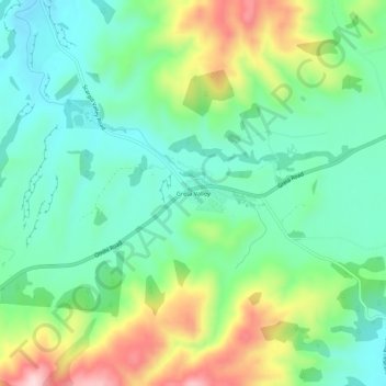
Name: Greta Valley topographic map, elevation, terrain.
Location: Greta Valley, Hurunui District, New Zealand (-42.98403 172.94829 -42.94403 172.98829)
Average elevation: 235 m
Minimum elevation: 132 m
Maximum elevation: 452 m
Thank you for supporting this site ❤️
Make a donation
Make a donation
Other topographic maps
Click on a map to view its topography, its elevation and its terrain.