Geolocate

Ulhasnagar topographic map

Interactive map

Click on the map to display elevation.

About this map

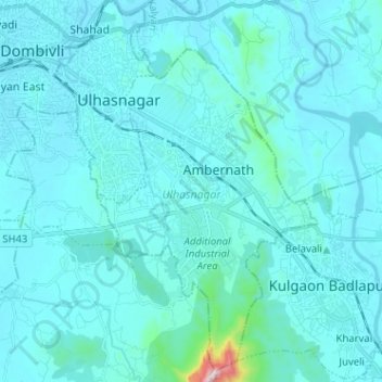
Name: Ulhasnagar topographic map, elevation, terrain.

Location: Ulhasnagar, Thane, Maharashtra, India (19.13592 73.14631 19.25480 73.22147)

Average elevation: 46 m

Minimum elevation: 0 m

Maximum elevation: 764 m

Other topographic maps

Click on a map to view its topography, its elevation and its terrain.

Lupin

India > Maharashtra > Palghar

Average elevation: 9 m

Dharavi

India > Maharashtra > Mumbai

Average elevation: 6 m

Dombivali

India > Maharashtra > Dombivali

Average elevation: 12 m

Chinchwad

India > Maharashtra > Chinchwad

Average elevation: 548 m

Nagpur

India > Maharashtra > Nagpur

Average elevation: 304 m

Ravet

India > Maharashtra > Ravet

Average elevation: 576 m

Nashik

India > Maharashtra > Nashik

Average elevation: 631 m