
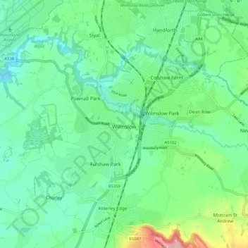
Wilmslow topographic map
Click on the map to display elevation.
About this map
Name: Wilmslow topographic map, elevation, terrain.
Location: Wilmslow, Cheshire East, England, United Kingdom (53.30563 -2.28793 53.34786 -2.18470)
Average elevation: 81 m
Minimum elevation: 43 m
Maximum elevation: 192 m
Other topographic maps
Click on a map to view its topography, its elevation and its terrain.