
Hospital topographic map
Interactive map
Click on the map to display elevation.
About this map
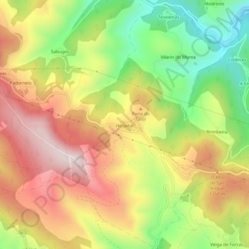
Name: Hospital topographic map, elevation, terrain.
Average elevation: 1,184 m
Minimum elevation: 893 m
Maximum elevation: 1,463 m
Other topographic maps
Click on a map to view its topography, its elevation and its terrain.
O Cebreiro
Spain > Galicia > Os Ancares > Pedrafita do Cebreiro
O Cebreiro, Pedrafita do Cebreiro, Os Ancares, Lugo, Galicia, Spain
Average elevation: 1,103 m