
Thank you for supporting this site ❤️
Make a donation
Make a donation
La Bernardière topographic map
Click on the map to display elevation.
Thank you for supporting this site ❤️
Make a donation
Make a donation
La Bernardière
Le territoire municipal de La Bernardière s’étend sur 1 480 hectares. L’altitude moyenne de la commune est de 54 mètres, avec des niveaux fluctuant entre 33 et 76 mètres.
Thank you for supporting this site ❤️
Make a donation
Make a donation
About this map
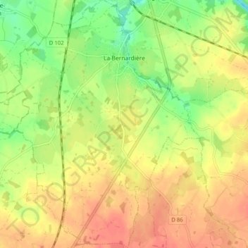
Name: La Bernardière topographic map, elevation, terrain.
Average elevation: 57 m
Minimum elevation: 28 m
Maximum elevation: 78 m
Thank you for supporting this site ❤️
Make a donation
Make a donation
Other topographic maps
Click on a map to view its topography, its elevation and its terrain.
Les Portes
France > Pays de la Loire > Vendée > Cugand-la-Bernardière > La Bernardière
Average elevation: 48 m