
Thank you for supporting this site ❤️
Make a donation
Make a donation
Villafufre topographic map
Click on the map to display elevation.
Thank you for supporting this site ❤️
Make a donation
Make a donation
About this map
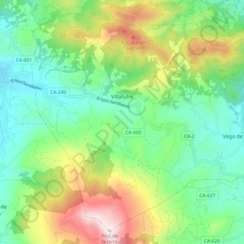
Name: Villafufre topographic map, elevation, terrain.
Location: Villafufre, Cantabria, Spain (43.23154 -3.92499 43.28812 -3.83846)
Average elevation: 335 m
Minimum elevation: 90 m
Maximum elevation: 833 m
Thank you for supporting this site ❤️
Make a donation
Make a donation
Other topographic maps
Click on a map to view its topography, its elevation and its terrain.