
Thank you for supporting this site ❤️
Make a donation
Make a donation
Mountain Dale topographic map
Click on the map to display elevation.
Thank you for supporting this site ❤️
Make a donation
Make a donation
Mountain Dale
Mountaindale is a hamlet (and census-designated place) in the town of Fallsburg in Sullivan County, New York, United States, situated at an altitude of 1,010 feet (310 m).
Thank you for supporting this site ❤️
Make a donation
Make a donation
About this map
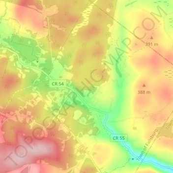
Name: Mountain Dale topographic map, elevation, terrain.
Average elevation: 363 m
Minimum elevation: 248 m
Maximum elevation: 455 m
Thank you for supporting this site ❤️
Make a donation
Make a donation